Blog number 4
After partially recovering from
the Gout attack we move on north via a circuit of June Lake another ski resort
and then on to Lee Vining, this is a town, not a US country singer, and its claim
to fame is that it’s located on Mono Lake.
 |
| Looking across June Lake |
This lake is quite large and is
10 times more salty than the Pacific Ocean. It’s a basin adjacent to the Sierra
Nevada and the Earth’s crust is only 1 mile thick beneath instead of the 30
mile average, it’s a time bomb waiting to explode. It’s already erupted several
times in recent history to create the 2 islands Negit and Paoha in addition to nearby
Black Point.
 |
| Looking across Mono Lake to the East |
The lakes level was lowered when
water was extracted for use in Western California unknowingly exposing some
huge stalagmite like structures called Tufa’s. These structures are created
underwater from carbonate salts oozing out of springs in the lake’s bottom.
 |
| Tufa's sitting up like ancient mushrooms |
Despite the high salt
concentration of this lake it still plays a major part in the migration process
of millions of birds who come here enroute from Alaska to Argentina. They stop
to feed on the miniature salt shrimp which thrives in this environment and once
gorged with shrimp they fly south for winter.
 |
| Newest formed mountain range in US just south of Mono Lake |
Our camp for the night is at the
Mono Lake lookout point along with a few other weary travellers who make camp
at all hours of the night, a few vans, another RV and a couple of brave tent
campers. The evening brings a wild thunderstorm our second so far. We are still
in the rain shadow created by the Sierra Nevada which creates the desert
conditions around this area giving it a lunar appearance.
 |
| Entering Yosemite National Park at Tioga Pass 9,945 feet above sea level |
 |
An alpine lake with snow clad mountains behind
|
 |
| Ditto |
Next day we head west into
Yosemite National Park, climbing up high into the snow covered Sierra Nevada Range
through massive granite gorges with sheer drops thousands of feet below right
on the edge of the road. The sights are breathtakingly beautiful as the photos
try to depict but without success. They just can’t capture the depth of colours
and scale of distance.
 |
| A meadow high up |
Once negotiating the hairpin bends and steep climb up the
eastern side through the entry gate at 10,000 feet elevation we came to an area
called Tuolumne Meadows which although
very cool was the classic trickling stream picture. Rolling meadow’s with
mountain fresh streams running westward through snow clad mountains, such a
contrast to our previous 4 weeks.
 |
| In winter this area is covered deep in snow and ice, only the very hardy plants manage to survive |
Hiking is a big thing here in Yosemite NP and because it’s
Independence Day (4th July) long weekend the trails were packed, we
decided to make our own bush track and with the vegetation being a bit sparse,
pine trees and summer wildflowers amongst the rounded granite mountains it made
for a relatively easy to climb. We did a big loop through the forest hoping to
spot some wildlife.
 |
| A startled deer caught frolicking in a lake |
Climbing is also a big past time in the US, heaps of people
head out for a weekend just to climb mountains, all shapes and sizes, you can
climb anywhere here, as long as you get a permit for the privilege.
 |
| View looking down to half dome mountain, through a telescope at this lookout we could see ant like figures scaling the side after trecking 10 mile to get to the base. |
 |
| Climbers on the left and another 2 up higher scaling the almost vertical granite face |
We reached the end of the scenic byway and had a choice to
head down into the infamous Yosemite Valley or North to get away from the maddening
crowds. We chose of course the latter. As we exited the park, the traffic was
backed up for more than 3 mile with people wanting to come in with only 6 hrs
left of the long weekend, didn’t make a lot of sense to us, but gave us some
forewarning about what to expect in popular places during holidays.
 |
| Pine tree with dangling moss which grows after winter |
 |
| The moss definitely does grow on the northern side of the trees and in huge quantities |
From here it was on to Sonora situated on the eastern side
of the Sacramento Valley, famous for its fertile lands and California’s vineyards.
We stopped at Walmart to resupply and YES a new camera. We decided to retire
our old camera (should have done it in OZ), it was never as good as our
previous Canon IXUS. We did however get another Canon which we hope will give
everyone a much better appreciation of the scenery and hopefully a few more
local critter shots.
 |
| On the Western side the scenery is completely different, much more water |
 |
| This lake is much lower than it should be, sucked almost dry |
 |
| A test for the new camera, see the small white dot on top of the mountain, we couldn't tell with our eyes till we zoomed in, check below!! |
 |
| Much betterer!! |
Back on the road again we head back east across the Sierra
Nevada, this time on a much less travelled highway through the pine tree
forests. Another spectacular road, albeit narrow, winding and extremely steep,
lucky our RV is only 25 feet long otherwise we would have struggled with the
tight steep switchbacks.
 |
| This says it all, it was only displayed once we had already travelled 50 miles, no other warnings |
 |
| Big Ponderosa Pine tree |
 |
| Same tree in vertical view |
 |
| Sugar pine cones |
So far most of our destinations have been National Parks,
Monuments etc, all have been excellent, our next was Lake Tahoe, this is a
lovely lake but also the epitome of America’s have’s and have not’s. Public
access is virtually forbidden except for those willing to pay, even just to go
to a beach. The waterfront has been privatised with luxury houses and, huge
wire barriers with “Do Not Trespass” signs scattered all over. The lake itself
is huge and sits at 6,000 feet above sea level with an average depth of 1,000
feet. It’s a multi season tourist destination with water skiing in summer and
snow skiing in winter.
 |
| Lake Tahoe, playground for the rich and famous |
 |
| This lake doesn't freeze over in winter, is all fresh water and a geological wonder |
Next stop at the Northern end of the Sierra Nevada is a much
more public friendly but not as impressive lake called Lake Almanor. Built by a
power company (Great Western Power) after the total displacement of the local
indigenous Indian population and the relocation of the white people to higher
ground. Named after the 3 daughters of the vice president of the company,
Alice, Martha and Eleanor.
 |
| A local eagle family at Lake Almanor perched high up on a light pole adjacent the dam wall watching out for dad, all very hungry |
 |
| Dad caught in action catching dinner for the family |
Moving north we left the Sierra Nevada behind and entered
the volcanic belt with our first stop at the Lassen Volcanic National Park.
This area is still quite active with numerous fumerols (bubbling mud) and
smelly sulphur gases exuding out of cracks in the Earth’s crust The mountain’s
are snow bound most of the year and even in Summer we had to climb over patches
of ice to traverse the trails.
 |
| A fumerol,(boiling mud) exuding hydrogen sulphide (rotten egg gas) |
 |
| A Steelar's Jay member of the raven family |
 |
| Lake Helen, frozen over |
 |
| Broken Mountain, rugged and cold. Part of the old volcano. |
 |
| Mount Lassen from the NW, apparently it's been sinking since 1990 and vulcanologists don't know why |
Peter Lassen was a pioneering Danish blacksmith who in 1848 coerced
new immigrants/settlers from Missouri to travel to his newly discovered
paradise hoping to make a fortune out of selling land he didn’t rightfully own,
only to have them stolen away by another enterprising entrepreneur called
William Nobles who discovered a better paradise further north claiming a much
easier track to California’s west coast. Not sure what the local Indians
thought about all this paradise finding, but guess they had little say in the
matter.
 |
| Mount Shasta at dusk, a classic looking volcano is over 14,000 feet high |
Onwards and upwards we get to the Lava Beds National
Monument in Northern California. This park has over 500 lava tubes with only 25
open to the public, some of the tubes go for several miles and link up with
very narrow passages. We picked up a couple of free torches from the ranger
station and spent the day exploring underground. The tubes are a result of hot
lava flowing from a now extinct volcano which became Medicine Lake situated
about 10 miles away. The tubes are created when the hot lava continues to flow
while the outer layer cools thus creating a hollow tube, many other tubes have
collapsed when the weight from above is too great and caves-in.
 |
| The sight of this creature made me don my Dunlop Volleys for the trip underground |
 |
| Rugged up and ready to explore |
 |
| Golden Dome lava tube, rightfully named, the gold colour is an algae which grows in total darkness |
 |
| Almost perfectly round, this is a classic lava tube |
 |
| The light at the end of the tunnel |
 |
| Same location with the flash on |
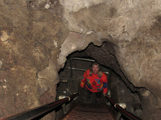 |
| Going down |
This area is also famous as the location for a battle and
long standoff between the local Modoc Indian Tribe led by the infamous Captain
Jack and the US army which was 10 times the size. After 1 major victory against
the army, he and his comrades were eventually defeated after nearly 12 months
defending themselves and their families within the lava beds. He was then
publicly hung for committing so called war crimes when in fact he had only
rebelled against his tribe being forcibly removed from their traditional land.
Funny how somethings never change.
 |
| A totem stick in memory of Captain Jack and the Modoc Tribe left at the site where they eventually fell |
The Modoc traditional land is now a partially drained lake
cut up into channels and used for continuous all year round irrigation to grow
hay, the wildlife is virtually non-existent whereas it was once a major stop
for migrating birds and a watering hole for wild game. Ironically the area is
now called a National Wildlife Refuge.
 |
| Shooting Info????? at a National Wildlife Refuge??????, no wonder its hard finding any wildlife |
BYE FOR NOW!!!
 |
| Beers and Cheers with a locally brewed stout much better than their other ales, the small glass is a bourbon and stout chaser, great for warming up the body. |
J&J


