|
| Sun flowers are wide spread throughout the prairies |
We left Donn’s place early as she
prepared for work and after a restful 5 days of eating, drinking and catching
up we headed for the US border. Manitoba is central in the North American
continent and 2hrs ahead of LA, so after losing time coming east we could now
slowly start to pick it up again as we headed southwest.
 |
| A coyote caught prowling through the wheat fields, he quickly fled |
 |
| A Pronghorn Antelope caught unawares these animals are the fastest in the western hemisphere second only to the cheetah in the whole world |
 |
| And a close up thank you |
We crossed into Minnesota at an
isolated crossing point without any hassles, and quickly turned westward into
North Dakota. Minnesota is renowned for its gun happy law enforcers, having just
recently shot an Aussie woman who was seeking assistance. Shoot first, ask
questions later, certainly applies here in this state.
 |
| A Mourning Dove found cooing for peace and harmony |
After miles of prairie farmland
and not a single rest area we found a small wildlife refuge a mile off the
highway. The refuge was an experimental forest and was looked after by a lonely
caretaker who never stopped talking. She was full of info and allowed us to
camp the night for free. The refuge had an amazing number of tree and plant
varieties as we found out the following morning while we hiked the 3 mile
trail.
 |
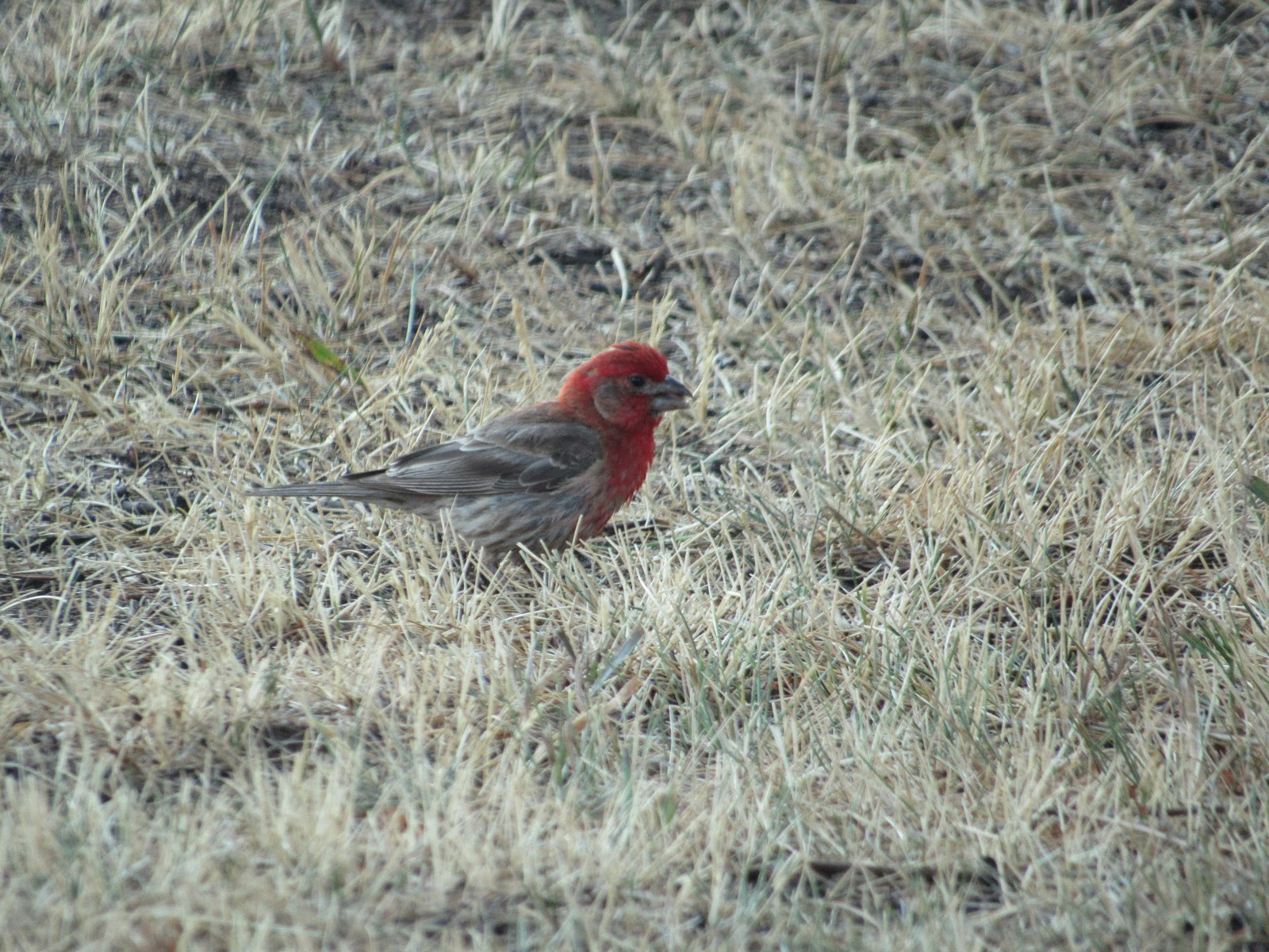
| A House Finch with noice plumage |
 |
| A Western Kingbird perched high up searching for insects |
We left late in the day and
intended to stop the night at Walmart in the next large town called Minot. Just
after arriving we were abused by a woman who had more metal attached to her
face than skin when we entered Walmart the wrong way (in her opinion). We tried
to explain but were told to get back to Montana and stay there, BITCH!! Didn’t
have the heart to tell her we were Aussie, and didn’t even come from Montana.
 |
| Even this guy would have been intimidated by the "Sheila from Nodak" |
We moved on to the next Walmart
130 mile further west which was very accommodating with wider lanes, larger
carpark and no stroppy sheilas. You have to be careful here in these states as
everybody totes a gun and their not shy to use it. It’s their constitutional
right to bear arms and they do!! It’s total madness, but hey it’s their
country.
 |
| No one argues with these guys when they are in a group, it took nearly 30 minutes to get passed as they strolled along the road |
Our next stop was Theodore
Roosevelt National Park, Northern Section, which is considered a “Badlands”
area but in fact is a very scenic valley along the Little Missouri River.
Theodore Roosevelt was one of the great Presidents of America. He lived in this
valley as a rancher before his presidency. After a tragic period in his life
where he lost his wife while she was giving birth to their first child and on
the very same day, earlier in the morning he lost his mother to Typhoid Fever.
He headed west to this location and ran cattle. He said this place gave him the
strength to return east and start again.
 |
| The Maltese Cross Cabin where Theodore Roosevelt lived at his ranch, very humble indeed |
 |
| The canyon here is cut by the Little Missouri River over millions of years and drops away from the flat upper prairies |
 |
| Looking down into the valley |
 |
| Looking south from the observation hut shown above |
 |
| And east along the valley |
I could go on and on for ages
about the forward thinking Roosevelt and his achievements during his life and
presidency but we came here to view the scenery, which was spectacular and the
critters which were numerous especially the little prairie dogs.
 |
| A very fat black tailed prairie dog giving warning to neighbours that humans approach |
 |
| Neighbours seeking protection after the call. They live in family groups within what are commonly called Prairie Dog Towns |
 |
| WOW is that a prairie dog down there, the dogs watch in awe as the hawk's sweep down on their neighbours |
 |
| Keep away or else |
 |
| Cute bunnies like this one will steal a prairie dog's burrow and call it home |
Further south and still part of
the Little Missouri River valley the South section of the TRNP is another
“Badlands” region. The Badlands are named such for many reasons but mainly
because the area is considered unusable and dangerous to be in. Temps are very
high in the multitude of small canyons where one can easily get lost. They were
created by erosion during the last Ice age 15,000 ago as the Missouri River was
the toe of the continental glaciation which spread down from Canada.
 |
| The Painted Canyon in the South Section |
We continued south into South
Dakota to a town called Spearfish which we thought would be nice to visit. It’s
just north of the Black Hills, a spectacular area of colourful mountains and
valleys. We had to share the area with approx. 1 million bikers from all over the continent, who were here
for an annual rally which has been a yearly event for many years.
 |
| Peace and solitude for a few hours getting away from the droning bikes in Black Hills |
 |
| Big bikes everywhere |
The rally centre was the adjacent
town of Sturgis and had been going for 10 days, due to conclude the weekend we
arrived. We had no idea this event was taking place and were amazed by the
numbers attending and driving around the roads. The valleys were deafening with
the roar of Harley’s, a favoured bike here in the US and rode mainly by
granddads re-living their childhood.
 |
| We ended up by chance in the main street of Sturgis on Saturday afternoon looking for propane and found the town packed |
The Black Hills has a checked
history and was home to famous people like Wild Bill Hickok and Calamity Jane
who lived and died in Deadwood, Bill being shot in the back of the head while
playing poker at a local saloon. Behaviour the bikers here could probably
relate to, and wished the old times still existed. The cowboys of yesteryear
are now the modern day biker.
 |
| Deadwood USA version of Dawson City |
 |
| One of the modern saloons of Deadwood, very much a tourist town now |
The area was deeded by treaty to
the local Lakota (Sioux) Indian tribe as being considered worthless by the
whites until gold was discovered by illegal prospectors, led by Lieutenant
Colonel George Custer. Custer and his (US representatives) drove the Indians
away from the hills by force sending most to a reservation in the desert.
 |
| Pactola Reservoir in the Black Hills another beautiful place to behold |
Custer was eventually killed in
the Battle of the Bighorn in neighbouring Montana. The Sioux Indians were
actually a number of different tribes which grouped together to fight the
injustice. Even today the fight continues as the Federal Government has offered
financial compensation which the Indians have refused, insisting on a return of
the sacred Black Hills.
 |
| Mount Rushmore lies in the middle of the Black Hills and was carved using dynamite, it's a feel good monument for many American people and it does idolise the best 4 presidents George Washington, Thomas Jefferson, Theodore Roosevelt and Abraham Lincoln |
 |
| A couple of mile away a monument of defiance is partly constructed, it will portray Crazy Horse the famous warrior |
 |
| The final carved image will be much bigger than Mt Rushmore |
Just south of the Black Hills at
Hot Springs we stopped at an active archaeological dig called the Mammoth Site.
It is now enclosed within a building and has exposed 61 complete mammoth
skeletons including tusks. The hill was intended for a residential development
but when the site was cleared it became evident that there was much below.
 |
| The Mammoth came in a number of varieties, this one was the smooth skinned Columbian Mammoth, it was the largest being 1.25 times the size of a modern African Elephant with tusks 4m long |
 |
| This skeleton gives a good indication of its size |
 |
| Mostly males were found in the dig so far |
 |
| A jumble of bones but the diggers can show how each animal probably died and fell |
 |
| This is a mammoth tooth and it's about 300mm long |
About 26,000 years ago mega fauna
inhabited the region and at this location a spring created a steep sided basin
where many animals fell in while drinking and couldn’t escape the mud and so
drowned. This occurrence continued for about 700 years until the spring dried
up and filled with sediment. They are not considered fossils as they have not
mineralised, but rather preserved by the clay and course sand.
 |
| This skeleton of a Giant Short Nosed Bear was also found and was twice the size of a modern grizzly |
 |
| But just as aggressive, not like the cute ones we saw |
 |
| Early man used the bones of hunted mammoth to build shelters, like this one, some large shelters were discovered with over 100 mammoth upper jaws. This may explain their extinction |
We headed back northeast to Rapid
City for some more supplies and then east to the South Dakota Badlands National Park.
Similar to the Badlands in North Dakota but on a much grander scale, covering
many miles and indeed extremely hostile to those not accustomed to the area.
 |
| The Badland's hills are like a painted sculpture |
 |
| Very little grows in this region |
 |
| The colouration is very distinct and represents different rock types, the yellow is 50 million years old |
We entered from the east end and
emerged back at the west end after a night at the free campground and a
horrendous thunderstorm with intense lightning strikes, a scary place to be.
The corrugated gravel access road through the park didn’t help matters either,
as we again had to make repairs to loose fittings shaken to the point of
destruction.
 |
| Carved out by wind and rain over millennium |
 |
| This baby bighorn sheep is surviving well enough |
 |
| The owner arrived back at camp after dark with a very puzzled look discovering his tent missing as it blew away during the storm |
We headed south towards Nebraska
through the southern section of the national park and stopped at a small town
called Wounded Knee which was the site where the Sioux Indians led by Chief Sitting Bull eventually
surrendered to the US Army. The army massacred 200 warriors, woman and
children, and became famous as the Wounded Knee Massacre. Again paranoia by the
US Army caused the death of many people.
 |
| South Badlands, same same but different |
The reservation is called Pine
Ridge (despite very few pine trees) and is home to the surviving relatives of
those early tribes. We were offered a selection of trinkets from three locals and bought
one from each, it is so sad to see grown men reduced to this when their ancestors who once were warriors, men of honour and proud to be the guardians of these lands. We didn’t
photograph the three guys as a sign of respect. The
trinkets were genuine Indian made and not from China, as we were repeatedly
informed, and could be taken on the big silver bird.
 |
| The Native Indian's try to survive in this harsh environment the best they can |
The drive through Nebraska was
uneventful as the western side of this state is all farmland and very
productive. It’s a credit to the farmers who have returned the land from
destruction when in the 1930’s the whole of the prairie was over grazed and
considered a dust bowl. Careful management has proven its worth as the crops
and cattle look very healthy despite the limited water supplies.
 |
| Nebraska doesn't offer much so they created this "Car Henge" |
Across the border into Colorado
and this time it is the eastern side of the state that is prairie farmland and
again very healthy. We stop up for a couple of days in Fort Collins a farm town
modernised overnight into a city, the highways are wide but the suburban
streets and carparks are a nightmare for us and the motorhome.
 |
| Colorado is one forward thinking state, the turbines stretched as far as the eye could see in both direction along this border ridge |
 |
| Who said the wind doesn't always blow, well here it does and from the same direction |
 |
| Solar cells soaking up the rays all these small facilities help |
We are at the
foothills of the Rocky Mountains and at the end of our prairie run.
Bye For Now
Beers and Cheers from Donn's with a delicious Moose Eye (beer mixed with Clamato juice)
J&J