We crossed the border into New
Mexico just near where Geronimo and his cohorts were captured. This was the
final moment in the long standing war against the Native American Indians. Just
like the Sioux and Comanche, the Apache tribes were defeated by the US Army and
forced to live on reservations in locations which white man considered
worthless. They had already killed 99% of the buffalo herds in their attempt to
starve the Indians out of their tribal lands, a wonton criminal act which went
unpunished.
 |
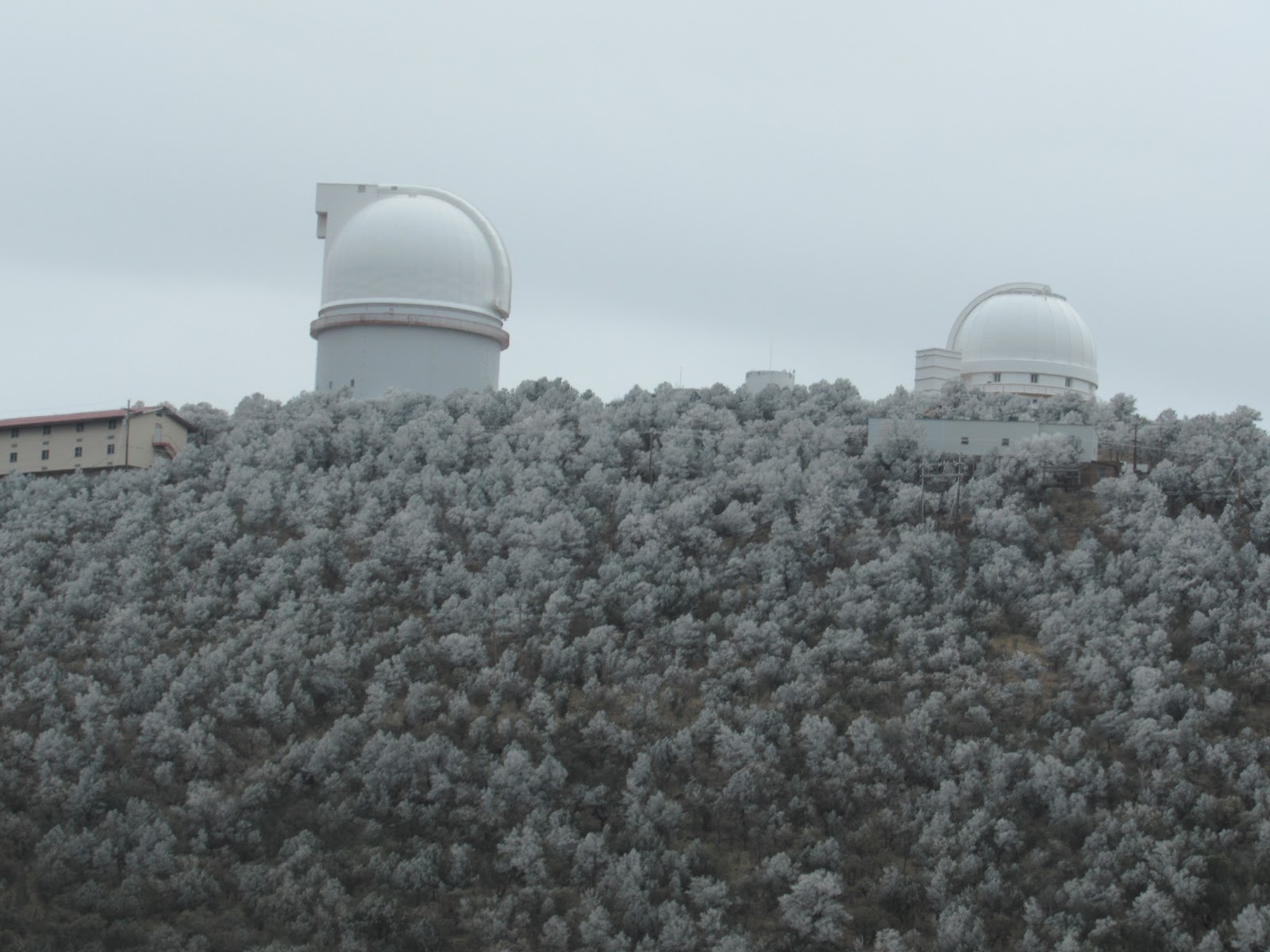
| Chiricahua Peak and the adjacent valleys where the Apache Indians survived before surrendering to the US Army |
 |
| There are over 50 varieties of Yucca Tree this one is still with seed pods |
The border also signifies the
separation between the east and west as it is here that the Continental Divide
runs North-South from the Canadian Border to Mexico following the Rocky
Mountains. In the far South where we are, the mountains are quite low only 8,000
feet at the peaks and below 4,000 feet in the lowlands. The Sonoran Desert has
changed into the Chihuahua Desert and despite having many similar plants and
animals it is vastly different in many other respects.
 |
| Another hawk waiting patiently |
 |
| Well maybe not too patiently |
East of the Continental Divide is
much colder and wetter, in winter the winds flow down from Canada sweeping
along the frozen Rocky Mountains bringing sub zero temperatures which we were
not expecting. We headed north where we climbed to the top of the divide at
Jacks Peak but were driven back south at Silver City when the temps dropped and
Jen got a bad dose of the flu and I got another dose of gout.
 |
| Gambel's Quail are like free range chooks in the desert |
We headed as far south as we
could snugging the Mexican Border as we progressed further east. We crossed the
border again at Palomas, Mexico for the day. This crossing was very quiet
without the hustle and bustle of spruikers, while the town was a bit sleazy
with locals just hanging about watching. We ventured only to the recommended
Pink Building for lunch, some souvenirs and then a pharmacy nearby to buy some
drugs. Medicine in Mexico is much cheaper than the States like about ¼ the
price.
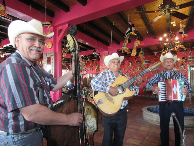 |
| A bit of Mexican cheer while dining at the Pink Place |
In Columbia the US town before
the border we found a State Park which for $14 per night we had a level pad
with electricity which was good for a flu and gout recovery. The temps were low
and the wind picked up with rain but we were snug as a bug with the furnace
blasting away to keep us warm.
 |
| The Pink Place is hard to miss |
We left Columbia before our
propane level dropped as low as the morning temp, and crossed the Texas Border
at El Paso. It is here that the Rio Grande River coming south from Colorado
through New Mexico turns south east and forms the border with Mexico continuing
for about 1,000 miles before emptying into the Gulf Of Mexico. Sadly, the Rio
was not so Grande, as at this time of year it’s mostly dry suffering the same
fate as the Colorado where most of the water is drained off for farming
irrigation.
 |
| Everything's big in Texas |
El Paso is not a quiet little
country border town but a lively bustling city nearly the size of Phoenix and
as the name suggests has only one passage through. The I-10 highway runs
through this passage with a maze of interconnecting offshoots and flyovers all
accommodating massive trucks hurtling along at 80 mph. It’s quite
terrifying!!!!
 |
| Many parts of New Mexico and Western Texas are quite poor with many towns being handed over to the ghosts |
We camped up at Walmart in
Horizon City just east of El Paso and restocked as we expected a long haul
before the next major city, after all nothing is as big as TEXAS. Western Texas
is still part of the Chihuahua Desert although it has much more grassland, the
old buffalo stamping grounds in winter. No buffalo to be seen nor many cattle,
despite ranches galore, we didn’t get any answers why the lack of cattle. We
did however find many dairy cattle living like battery hens in suburban areas
obviously to keep the transport costs down.
 |
| This is one hell of a Yucca |
Travelling the plains of Texas we
headed for the Guadalupe Mountain National Park which contains the highest peak
in Texas. The peak 8,749 feet is very low compared to other mountains in the US
and it is for this reason many people are attracted to it at this time of the
year in their attempt to be on top of Texas. We declined as the forecast temp
for the peak was below zero with strong winds and expected 12 hour return hike.
 |
| El Capitan in the Guadalupe Mountains NP was a sentinal for the stage coach to turn NW while travelling from St Louis to San Francisco 2,800 miles in 24 days |
Again it was too cold for us so
we headed south and then further south again till we reached the Rio Grande and
Big Bend National Park. This national park is extremely remote and is situated
where the river makes a 90 degree turn. The Rio Grande cuts through 1,500 feet
high ancient limestone canyons and the mountains within the park are like
islands in the desert. High in the mountains you can find all the plants and
animals that would be found in northern states like juniper and pinion pines
along with mountain lions and black bears (albeit illegal Mexican Black Bears).
The biodiversity has been maintained despite the isolation.
 |
| Early morning along the Rio Grande |
 |
| Desert Islands like this appear to be lifeless but in fact harbour a great variety of life forms |
We found camps at both ends of
the park and spent many days observing the wildlife and taking in the amazing
sights. Many of the roads required 4wd so we couldn’t access the more remote
areas unfortunately, but what we saw was very impressive. Being so isolated the
park was suited for the enthusiasts rather than the tourists which was an added
bonus and a rare find.
 |
| Spectacular formations carved by both wind and rain |
 |
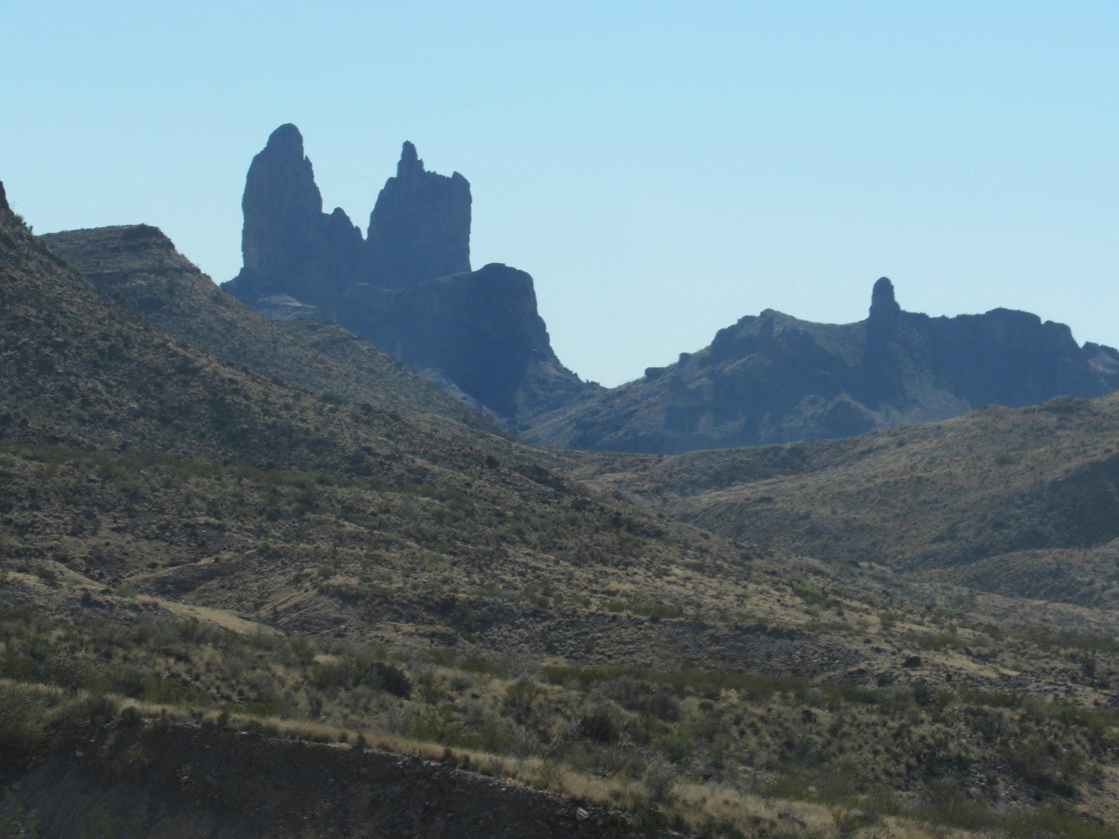
| Protrusions like this volcanic plug were pushed up through the surface |
At the rangers station we
enquired about what we could expect further east and were informed that the
temps would not improve, in fact probably get colder, despite going further
south. It’s only Florida, which is still about 3,000 miles further east where
it’s warmer. The eastern states area is very much more crowded with people and
traffic and the scenery mostly boring and critters hard to find.
 |
| Santa Elena Canyon from a distance. |
 |
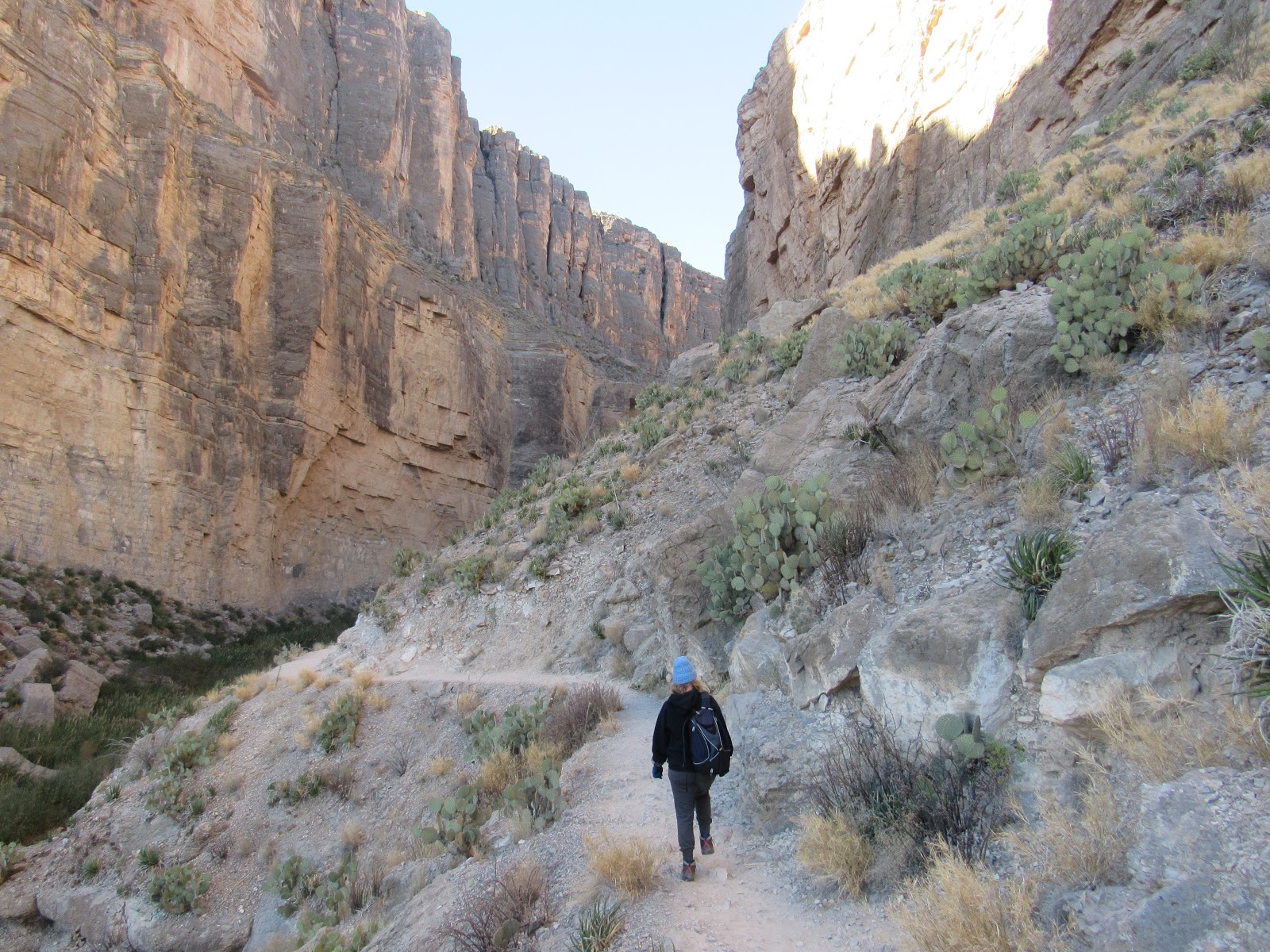
| The walls are 1,500 feet high with Mexico to the left and USA to the right |
 |
| Santa Elena Canyon was carved out by the Rio Grande as the limestone was slowly forced upwards along a fault line |
 |
| The Rio Grande further east in the park after the big bend, its a wild river in the summer wet season |
 |
| A different hawk |
 |
| Hey Mexican get outer my country |
 |
| It's up high here where the animals have become stranded |
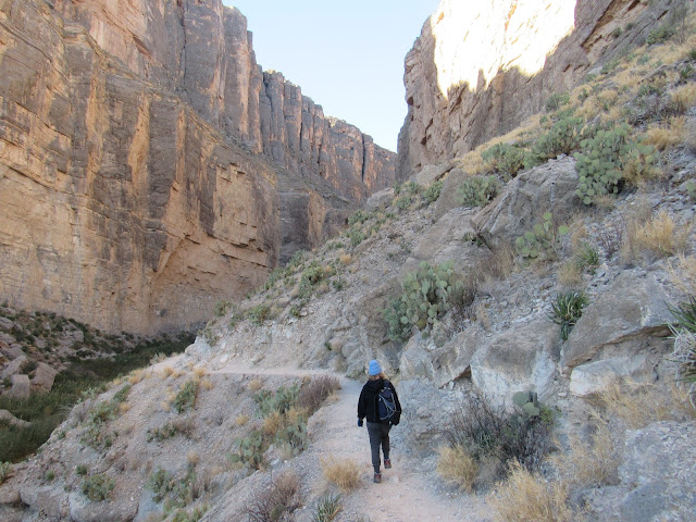 |
| Hiking the canyon |
 |
| These 1,500 feet walls were once part of a coral reef submerged below the ocean |
Southern Mexico is much warmer but
we don’t have sufficient info yet to attempt anything other than day trips. We’ve
been informed it can become a nightmare if one’s not prepared properly. We
would need to apply for visas, get separate vehicle insurance, pay cash RV bond
fees, book campgrounds, different propane bottles etc, etc and talking Spanish
would help.
 |
| A young coyote, they are very timid at that age but still very cunning |
 |
| This Roadrunner is very much alive and I was very grateful for his pose, they only seem to race when crossing the road in front of you |
 |
| A grey fox slinking around the campground a minute later it jumped high in the air and disappeared down a hole |
 |
| A Gila Woodpecker searching for a feed |
 |
| A much better pose |
 |
| Arvee 'For Sale' it will be sad to see it go just a shame we can't bring it home |
Adios Amigo’s
Beers and Cheers from the Mexican side with a revitalising frozen Margarita or 2.
Hasta La Vista
J&J


so good reading your Blog, always nice to see your faces at the end also :)
ReplyDeletelooking forward to catching up when you are back home
Juliette